
Boulder ZIP Codes at a Glance
Boulder County program material lists sixteen Boulder-area postal codes. The first five are the standard ZIP and Census ZCTA core most often associated with the city. The rest can be PO Box, special, nonstandard, or broader routing designations whose exact service area must be checked for a specific address. The post-office and routing notes below preserve what the research verified and mark gaps rather than turning an uncertain label into a boundary.
| ZIP | Areas Covered | Post Office | Notes |
|---|---|---|---|
| 80301 | East and northeast Boulder, including the Gunbarrel vicinity | Boulder S&DC, 2995 55th Street, 80301-9997 | Standard ZIP and ZCTA; Gunbarrel can be outside city limits, so verify with GIS |
| 80302 | Central Boulder, downtown, foothill, and Boulder postal city areas | Boulder Main Post Office, 1905 15th Street, 80302-9998 | Standard ZIP plus PO Box route; postal city does not set the municipal line |
| 80303 | Southeast Boulder and the Baseline area | Boulder S&DC routing notice lists 80303 | Standard ZIP and ZCTA; city and county boundaries do not match the code |
| 80304 | North and northwest Boulder with adjacent postal areas | Boulder S&DC routing notice lists 80304 | Standard ZIP and ZCTA; verify parcel jurisdiction |
| 80305 | South Boulder and the Table Mesa area | High Mar station, 4985 Moorhead Avenue, 80305 | Standard ZIP and ZCTA; county material also covers nearby non-city addresses |
| 80306 | Boulder PO Box or nonstandard postal designation | Assigned station not located in official USPS source | County program list; check exact address eligibility with USPS |
| 80307 | Boulder PO Box or nonstandard postal designation | Assigned station not located in official USPS source | County program list; do not treat it as a city-limit polygon |
| 80308 | Boulder postal or nonstandard route | Boulder S&DC, 2995 55th Street | County list and 2026 USPS routing notice; exact service area not verified |
| 80309 | Boulder unique or special route associated with an institution or campus use | Assigned facility not located in official USPS source | Unique-ZIP rules may apply; exact institution boundary not verified |
| 80310 | Boulder unique or special route | Boulder S&DC routing notice lists 80310 | Exact assigned entity or area not located in official USPS source |
| 80314 | Boulder postal or nonstandard route | Boulder S&DC, 2995 55th Street | 2026 routing notice lists it; exact assigned place not located |
| 80321 | Nonstandard Boulder postal designation | Assigned facility not located in official USPS source | County list and older L606 routing group; verify the address |
| 80322 | Nonstandard Boulder postal designation | Assigned facility not located in official USPS source | Exact ZIP type and area not located in official USPS source |
| 80323 | Nonstandard Boulder postal designation | Assigned facility not located in official USPS source | Exact ZIP type and area not located in official USPS source |
| 80328 | Nonstandard Boulder postal designation | Assigned facility not located in official USPS source | County list and older L606 group; a specific address is required |
| 80329 | Nonstandard Boulder postal designation | Assigned facility not located in official USPS source | Exact ZIP type and area not located in official USPS source |
The table is a routing reference, not a complete household directory. Census profiles prominently model standard ZCTAs 80301 through 80305. A ZIP can include city parcels, county pockets, and special routes, while a parcel in Boulder County can carry another postal city. Use the USPS result and the situs parcel before choosing a resident record path.
Boulder’s Core ZIP Code Corridor
The core standard codes divide Boulder by postal routing rather than by a clean neighborhood ring. ZIP 80301 reaches east and northeast Boulder and the Gunbarrel vicinity. ZIP 80302 covers central, downtown, foothill, and postal-city areas. ZIP 80303 points toward southeast Boulder and Baseline. ZIP 80304 covers north and northwest areas, while ZIP 80305 serves south Boulder and Table Mesa. These descriptions help narrow a search, but the parcel and city line remain separate checks.
The Census ZCTA view for Boulder illustrates the statistical geography used for standard postal areas.
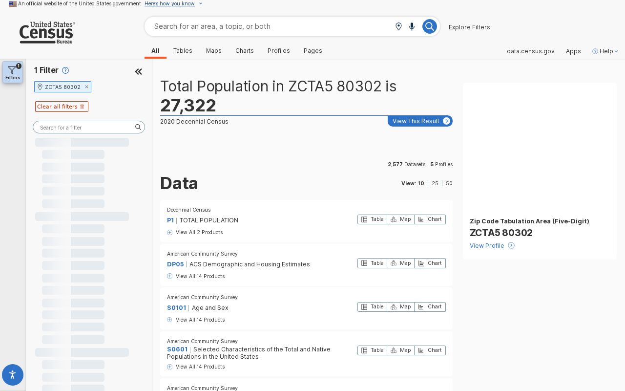
A ZCTA is a Census approximation for statistical reporting. It is useful for population and geographic context, but it is not a live USPS delivery answer and does not prove that a parcel lies inside the City of Boulder. Keep ZCTA, postal ZIP, city limits, and county jurisdiction as four related but distinct labels.
Note: Core ZIP descriptions narrow the search area, while USPS must confirm the code for the exact standardized address.
Boulder’s Extended ZIP Code List
The extended codes need more care than the standard core. The county list includes 80306, 80307, 80308, 80309, 80310, 80314, 80321, 80322, 80323, 80328, and 80329. Research did not locate stable official text assigning a post office, institution, or complete delivery area for several of them. That is a real research gap, not permission to fill the row from an old map or a guessed campus name.
The USPS ZIP Code basics explanation distinguishes standard delivery codes, PO Box-only codes, and unique codes assigned to one organization or a destination with enough volume.
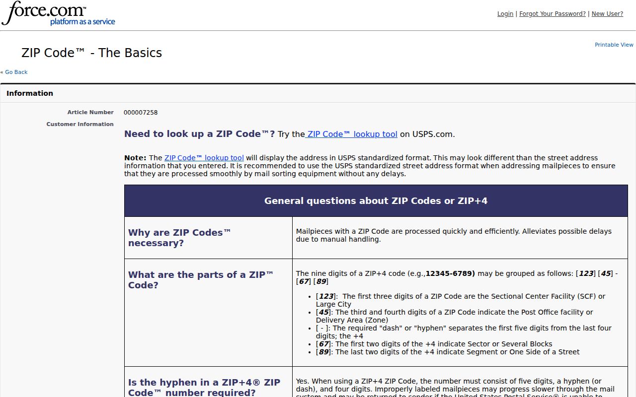
For a nonstandard code, enter the full street, city, state, and known ZIP in the address lookup. Keep the returned standardized address and the source date. A county program list can tell a researcher that a code belongs in the Boulder postal family, but only the address-level USPS result can resolve a particular delivery point.
Do not convert a PO Box or unique code into a claim about everyone at a physical parcel. Postal routing may group an institution, a high-volume destination, or a box section. The code is a lead for the next record system, not the evidence itself.
Find Boulder Residents by ZIP Code
A ZIP code directory search should move from postal confirmation to the record type that can answer the person question. Start with one address or one known name. Broad claims about everyone in a code require a regulated data product, and the public portals do not all offer a ZIP-wide browse.
- Open the USPS address lookup and enter the street, city, state, and known ZIP. Save the returned standardized form and note any changed city or ZIP.
- For one possible voter, use Colorado GoVote with First, Last, ZIP, and full Birthday. If a move may have occurred, retry the prior ZIP. A confidential or protected record may not appear.
- For a property lead, use Boulder Assessor fields for address, owner, street, subdivision, account, parcel, or S-T-R. The Assessor search does not document a dedicated ZIP filter, so do not present it as one.
- Use county GIS and city map layers to compare the parcel situs, CityLimits, Annexation, subdivision, and postal label. A ZIP-wide result needs a jurisdiction check for each parcel.
- When a code narrows the address set, shift to the Boulder street directory for parcel-by-parcel records rather than treating the postal code as a person list.
The USPS address result screen is the right place to verify a specific route before the records search begins.
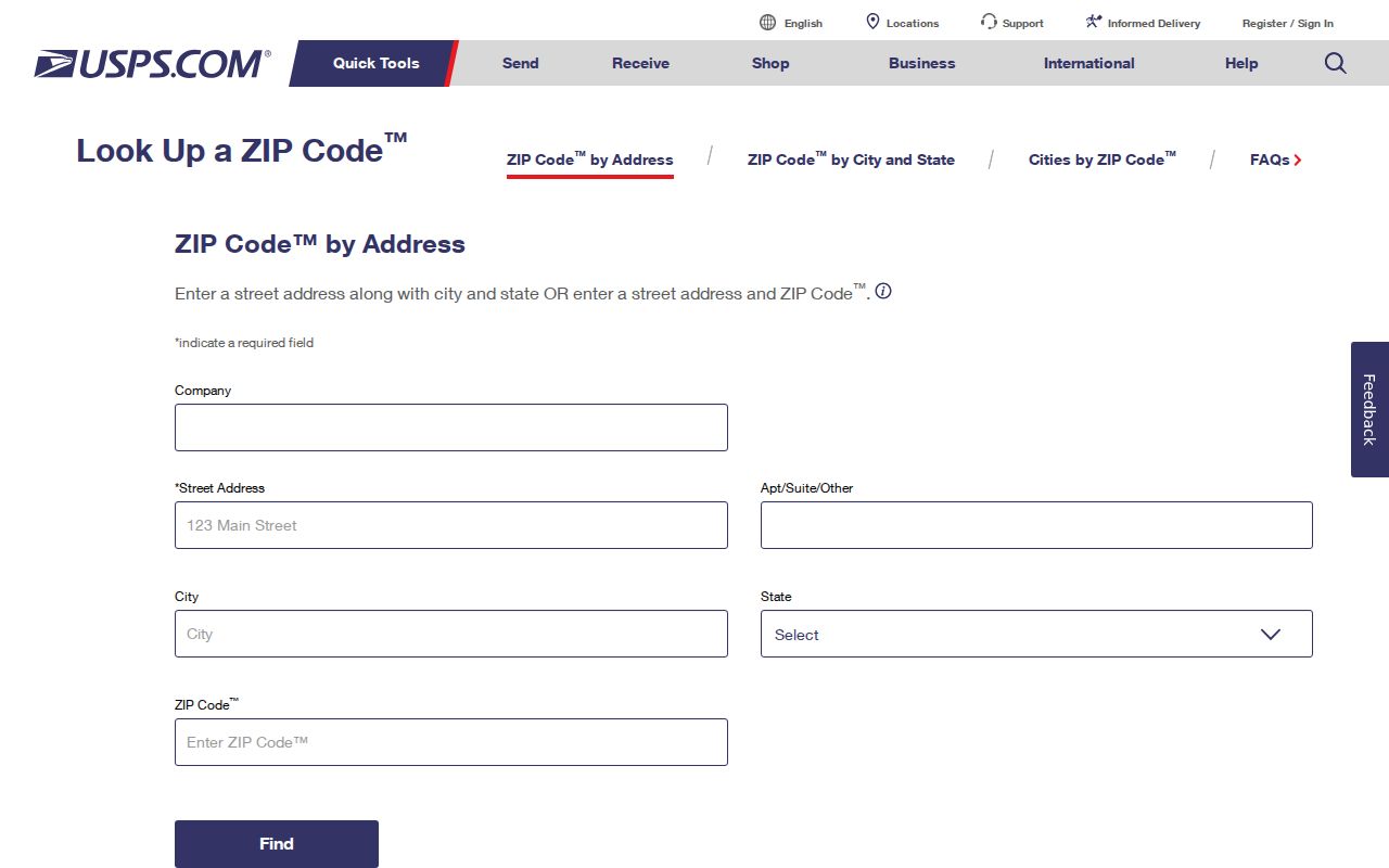
That lookup is dynamic, so session result URLs can change. Copy the standardized address and record the date instead of relying on a temporary result link. The same habit helps when an old directory uses a former postal city or omits a ZIP.
Boulder ZIP Search Fields and Limits
GoVote is the clearest public person-specific ZIP search because ZIP is a required field. It is still a one-person match. The Assessor is geographic and parcel based, with address and owner routes but no documented ZIP filter. County voter-file products can contain residential and mailing ZIP fields, but the product, request, time window, certification, exclusions, and fees control access.
| Portal | Field Label | Required | ZIP Use and Format |
|---|---|---|---|
| GoVote | First | Yes | First name for a one-person registration match |
| GoVote | Last | Yes | Last name; retry the former ZIP after a move |
| GoVote | ZIP | Yes | Registration or residence ZIP used with the name |
| GoVote | Birthday | Yes | Complete date in MM/DD/YYYY format |
| GoVote | Search or submit | Not applicable | Dynamic button text was not fully rendered in inspection |
| Assessor | Address | No | Street address; use the returned situs and mailing fields |
| Assessor | Owner Name | No | Current indexed owner; try variants, trusts, and entities |
| Assessor | Street Name | No | Geographic sweep; not a ZIP-wide person list |
| Assessor | Subdivision | No | Subdivision filter where available |
| Assessor | Account, Parcel, S-T-R | No | Parcel identifiers; S-T-R example is 5-2N-69W |
| Assessor | ZIP | Not a field | No dedicated ZIP filter was documented; use address text, address exports, or GIS |
GoVote can withhold Social Security number, driver-license number, month and day of birth, signature, email, protected-voter data, and ballot choices. The county bulk route is not an unrestricted roster. Its VR-011B and election products use residential or mailing address fields in dated products, with request forms and statutory exclusions. A ZIP match confirms a registration record, not present physical residence or every person in the household.
Boulder ZIP Routing Changes by Year
Postal routing changes can make old lists and current searches appear to disagree. The 2017 Postal Bulletin describes local examples in which 80305 and 80307 were realigned to Boulder 80305, while 80309 and 80310 were realigned to Boulder 80301. Older L606 groupings placed 80301 and 80308 through 80310 under Boulder 80301, 80302 and 80306 under 80302, 80303 and 80304 under 80303, 80305 and 80307 under 80305, and 80321 through 80323 plus 80328 under 80321.
The 2017 USPS Postal Bulletin and the 2026 Sorting and Delivery Center update are routing references, not city-boundary maps. The 2026 notice lists Boulder S&DC assignments for several current codes, including the 80301, 80303, 80304, 80308, 80310, and 80314 routes described in the coverage table.
Use the newer operational notice for the current routing context, then verify the address directly. A historical directory, deed, voter file, and postal label can each describe a different point in time. Preserve the year before deciding that a ZIP change is a record error.
Boulder ZIP Codes Versus City Limits
A postal city is not a municipal boundary. Gunbarrel can use the Boulder postal label with ZIP 80301 or 80503 while remaining outside the City of Boulder. Gold Hill can use Boulder 80302 while its local geography is different from a central Boulder parcel. The county's unincorporated-town material makes these examples useful warnings for any ZIP code directory.
The Boulder County unincorporated-towns information supplies the postal examples. For the legal boundary, compare the parcel situs with the CityLimits and Annexation layers in the City of Boulder planning GIS service directory.
Boundary history is active. Ordinance 8734 was approved February 19, 2026, annexing 24.04 acres at 5399 Kewanee, 5697 South Boulder Road, and the 55th Street right-of-way for the East Boulder Community Park area. A current ZIP result does not tell whether the parcel was inside the city before or after that change. Check the annexation layer and the dated parcel record.
Boundary check. Match the USPS standardized address, parcel situs, CityLimits layer, and any relevant Annexation record before assigning a Boulder resident to a city-wide geographic count.
Boulder ZIP Postal Terms to Know
Postal terms become important when a code is used as a search key. A standard code is not the same as a PO Box route, and a Census ZCTA is not the same as the live USPS delivery result. These plain definitions help keep a ZIP code directory precise.
- ZIP versus ZIP+4
- A ZIP identifies a broader postal delivery area. ZIP+4 adds four digits for a more specific delivery segment or destination.
- PO Box ZIP
- A code used for post-office boxes rather than ordinary street delivery. It can point to a postal facility without naming a physical residence.
- Unique ZIP
- A code assigned to one organization, institution, or high-volume destination under USPS routing rules.
- Carrier route
- A smaller delivery path within a postal area used to organize the carrier's stops. It is a routing concept, not a public list of residents.
- ZCTA
- A Census statistical approximation of ZIP geography used for data profiles. It should not replace address-level USPS verification.
A mailing address can also contain a PO Box, trustee, representative, or different city. Assessor records distinguish the mailing address from the situs address, while a deed uses a legal description and a directory may use the wording printed in its publication year.
Boulder Mountain Addressing and ZIP Checks
Mountain addressing adds a physical-location check to the postal check. The county describes mile-point street addressing for emergency response. The example 1138 Poorman Road means 1.138 miles from Sunshine Canyon Drive, with even numbers on the right and odd numbers on the left. Green plates and the Sheriff's emergency atlas help locate a road that does not behave like a downtown block.
The Boulder County mountain-addressing page provides the mile-point explanation shown in the image.
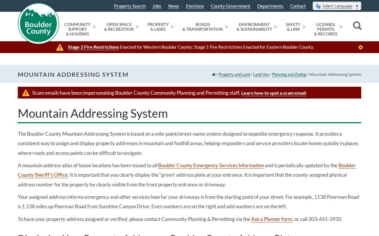
For a mountain address, compare the green plate, county parcel pin, situs address, USPS result, and ZIP. An old directory can omit a ZIP or use a former postal city, while a modern map can show the parcel under a county jurisdiction. The safest postal-area match is the one that preserves the road name, mile point, parcel, and source date together.
Boulder ZIP Numbers Are Not Resident Counts
The 2024 Boulder County election report counted 235,603 active registrations countywide, including 68,342 in the Boulder location row. The report did not provide a complete standard-ZIP registration table in the inspected material. Those figures are useful scale, but they do not tell how many people live in a ZIP, how many parcels are in it, or where the city line falls.
Census ZCTA profiles can supply statistical population context for standard codes. They do not replace a live USPS lookup, and they do not turn a postal area into a neighborhood or resident directory. Per-ZIP registration data remains a research gap requiring the proper county or state product, date, fee, certification, and privacy rules.
Several nonstandard-code assignments also remain unverified in stable official text. Dynamic USPS results, no single official ZIP boundary layer matching city limits, and changing annexation records all favor a source-by-source check. A ZIP code directory is most reliable when it states what is known and preserves the gaps.
Note: A ZIP total or ZCTA statistic describes a reporting geography, not every person who may receive mail there.